Gulag camps in maps and satellite images
View camps along the Dead Road in satellite images and archival military maps. Thanks to the collection of maps that we have amassed to date, you can form a good picture of the number of camps and the extent of the Dead Road construction project, of which we have documented only part.
Archival military topographical maps
While the archival military maps (in the original scale 1:200,000) date from the turn of the 1960s and 1970s – so nearly 20 years after the abandonment of the Dead Road – they capture almost the entire course of the railroad and the majority of camps along it and were therefore a valuable source of information for us, and not only in planning expeditions. Individual camps, situated between 5 and 10 kilometres from one another, are most frequently marked as “settlements” or “buildings”, quite often giving the relevant kilometre of the railroad where the camp was located.
To date we have processed a total of 44 scans of map sheets covering the entirety of the Dead Road from Salekhard to Igarka. You can view the results in the form of a seamless map in the map window (Old military layer…).
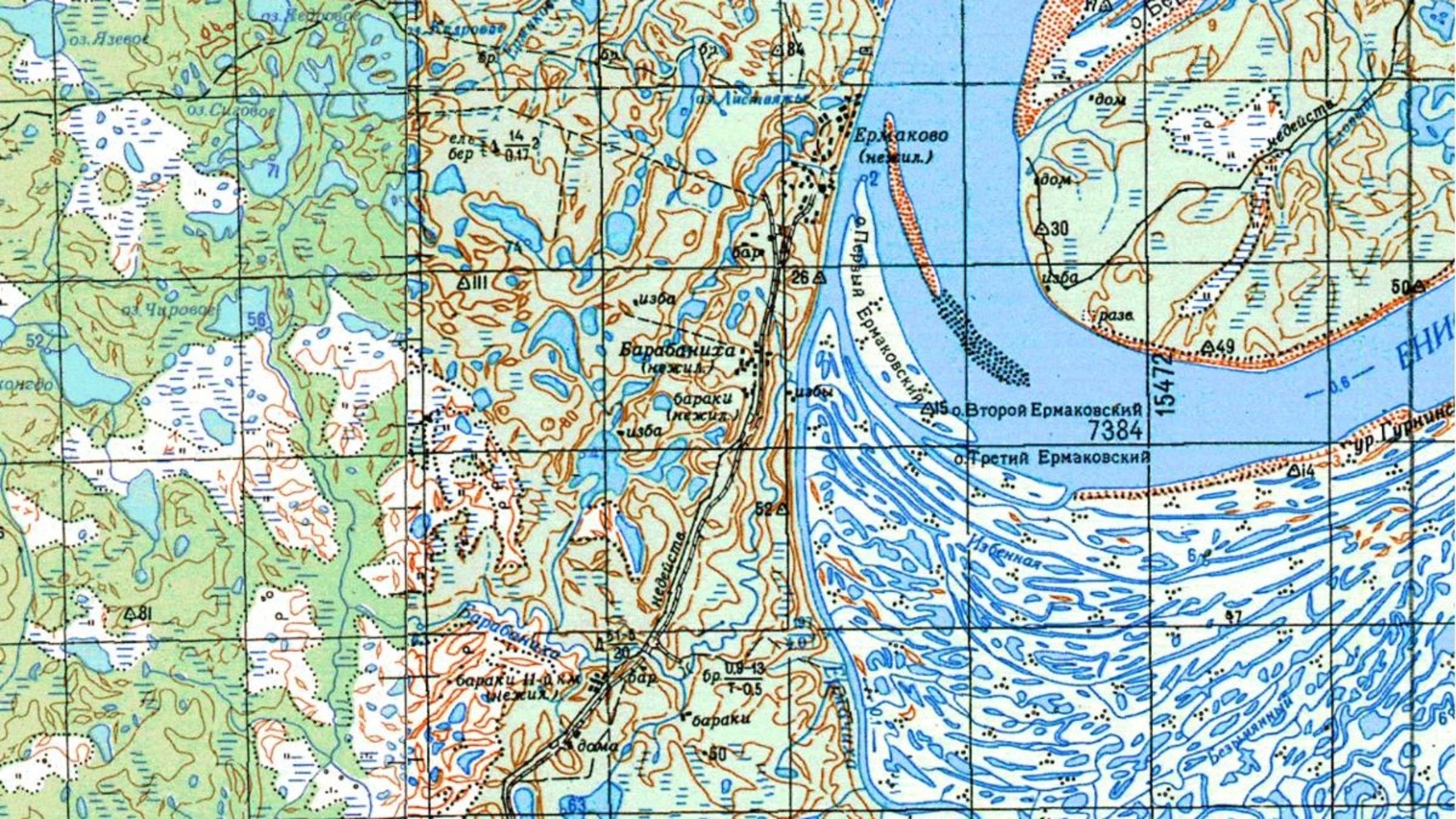
The areas around Ermakovo and Barabanicha on 1970s military maps
Detailed satellite images
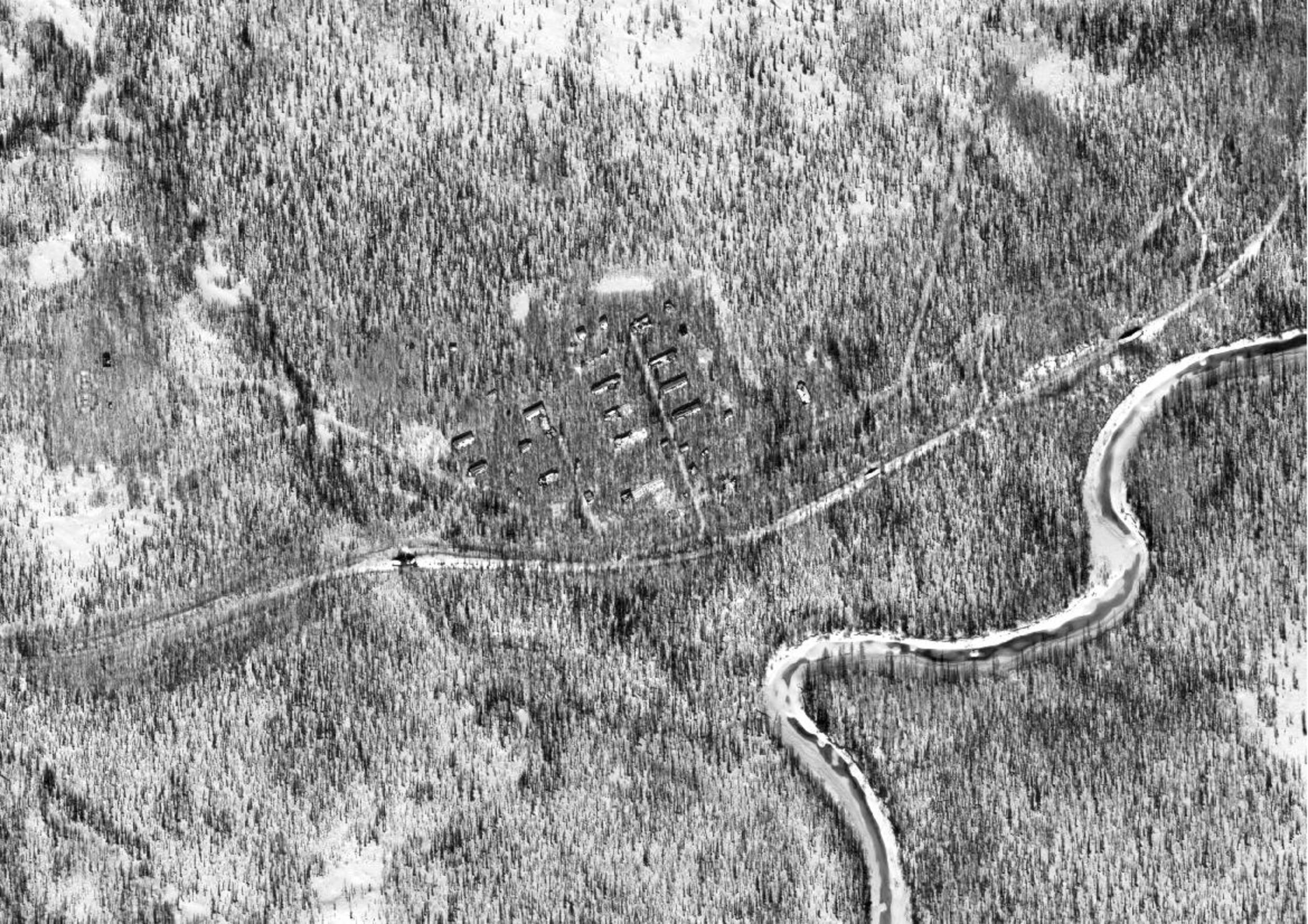
Thanks to old military topographic maps we were aware of two camps north of the Turukhan River (the 48th kilometre labour camp and 51st kilometre labour camp) that lie beyond the detailed resolution of commonly available web services. During our last trip we didn’t have much time to spare – or any certainty that anything would have been preserved at those camps. Therefore we decided not to visit them. Through an analysis of available multispectral images from the Landsat satellite, we discovered that at least one of the camps might be in a decent state. On the basis of those results we decided to purchase a detailed panchromatic image of that camp captured by the Worldview-1 satellite, so as to ascertain with absolute precision the condition of those camps. And what do you know – some of the buildings are perfectly preserved. On an image north of the camp there is even a clearly visible quarry to which a branch line of the main railroad led. You can view the entire detailed image produced in the map window (Detail satellite layer…).
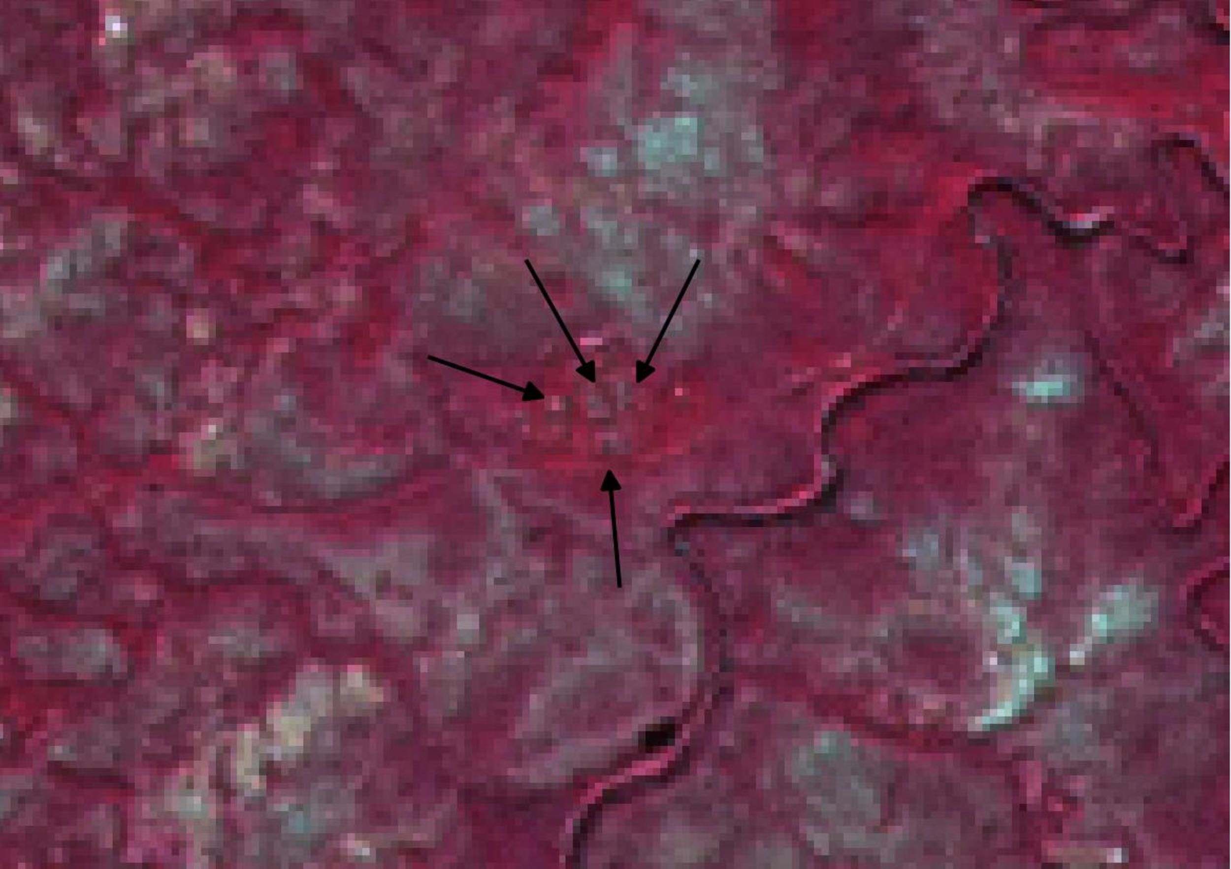

We adopted the same approach as with the two preceding camps with the one at the 169th km on the Bludnaya River. Though it is marked on topographic maps, we did not make it there during the expedition due to a faulty motorboat. But the mysterious camp remained in our minds, so we acquired a satellite image from the QuickBird satellite for the area where the camp ought to be. There was no sign of it. After lengthy study, we finally managed to locate one standing building from the whole camp (it was originally inside the camp); the rest had without exception been removed. There are not even any monuments along the otherwise recognisable camp perimeter and it is overgrown with thick vegetation. The outcome was therefore something of a disappointment to us.

The remains of the Bludnaya camp in an image from the QuickBird satellite (© COPYRIGHT 2015 DigitalGlobe, Inc.)